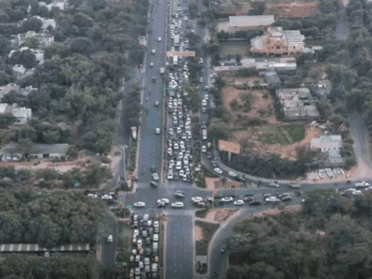


India is experiencing its second-driest June in the 126-year history of monsoon rainfall records. As of 21 June, the country had received only 57.4 mm of rainfall, which is 42.2% below normal.
The driest June remains 2009, when rainfall was 49% below average, severely affecting agriculture in central and north-west India.
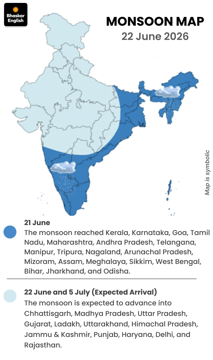
However, the monsoon may begin advancing again after a two-week pause. A weather system has developed over the Bay of Bengal and is expected to help the monsoon move into Chhattisgarh.
Heavy rain lashed parts of Meghalaya on Sunday. Mawsynram in East Khasi Hills recorded 530 mm of rainfall in just 24 hours, roughly the amount of rain that Jodhpur and Bikaner receive over six months.
Meanwhile, hailstorms were reported in Sriganganagar, Rajasthan, on Sunday. A heatwave alert has been issued for five districts of Madhya Pradesh, while heatwave conditions are expected in 38 districts across Uttar Pradesh.
Satellite image shows moisture moving from the Bay of Bengal
Weather officials say satellite images show moisture-laden winds advancing from the Bay of Bengal, which could help strengthen monsoon activity in eastern and central parts of the country.
Weather pictures from across the country
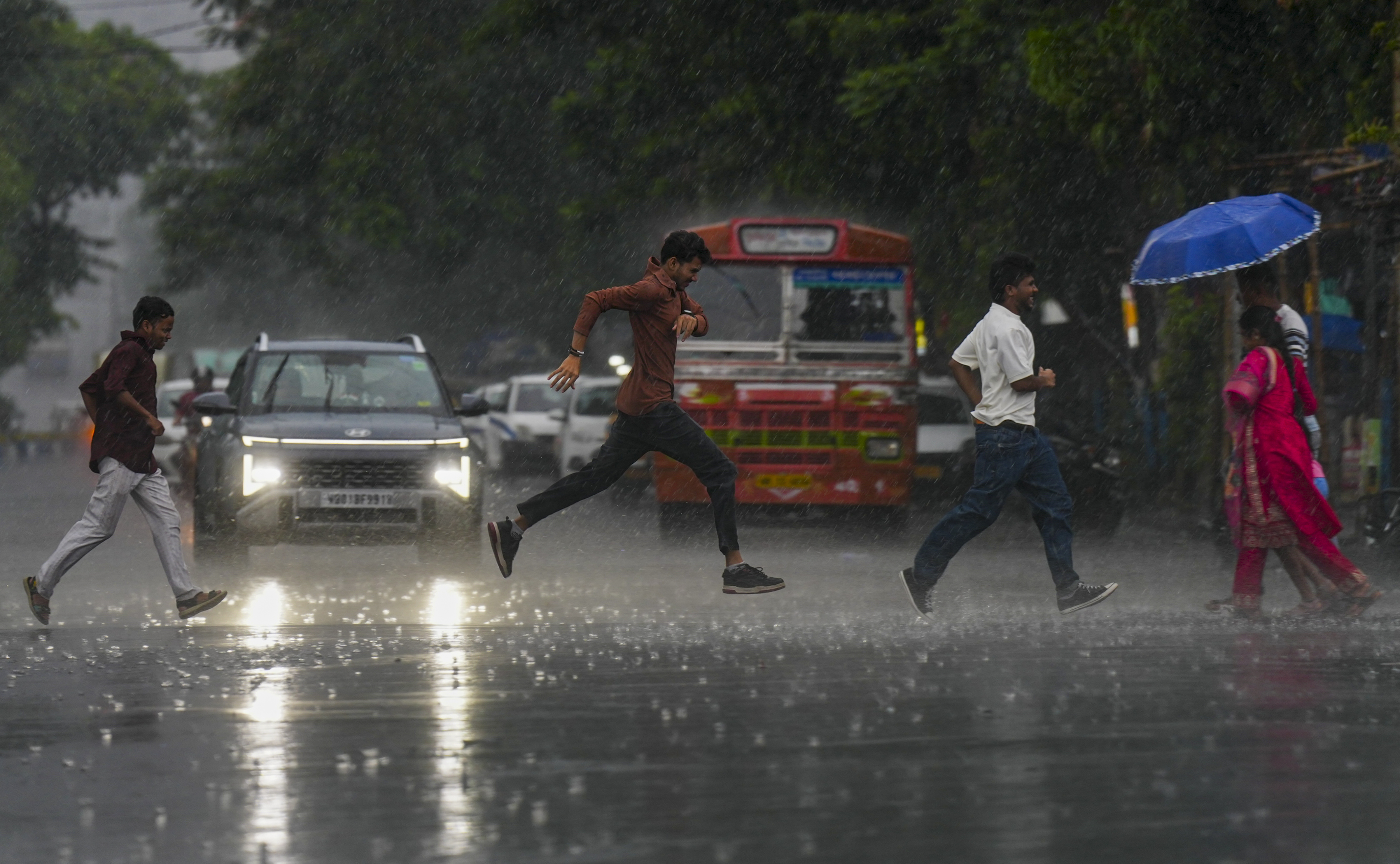
Heavy rain occurred in Kolkata, Bengal, on Sunday. The weather suddenly changed during the day, causing people to run to avoid getting wet.

Monsoon clouds are causing rain in Tamil Nadu. A tornado was seen amidst dark clouds in Thoothukudi on Sunday.

Destruction caused by the storm that had hit Tamil Nadu
Eight states grapple with heatwave; Vidarbha continues to face hot nights
Temperatures remain between 40°C and 42°C in parts of Uttar Pradesh, eastern Madhya Pradesh and Vidarbha. Similar temperatures have also been recorded in isolated areas of Telangana, Bihar, Gujarat, Haryana, Jharkhand, Odisha, Rajasthan and other parts of Uttar Pradesh.
The prolonged heat is making nights unusually warm in eight districts of Vidarbha, where a night-time heatwave alert remains in place.
Meanwhile, Banda in Uttar Pradesh remained the hottest place in the country for the second consecutive day, recording a maximum temperature of 42.6°C.
Temperatures above 42°C were also recorded in Kanpur, Varanasi, Bahraich and Prayagraj. Sriganganagar in Rajasthan and Rohtak in Haryana also saw temperatures rise above the 42°C mark.
What has happened due to the monsoon slowdown? Four key points
Sowing affected
Total Kharif crop sowing up to June 12 fell by 3.9% compared with the same period last year, covering 8.46 million hectares.
Impact on crops
The area under pulse cultivation declined by 43.2%, while cotton cultivation dropped by 28%.
However, paddy sowing increased by 28.4%.
Some relief
Water levels in reservoirs currently stand at 28.3% of total capacity, which is 16% higher than the 10-year average. This provides a buffer for irrigation needs.
Main risk
The situation will largely depend on rainfall during July and August. If rainfall remains below normal, pressure on food prices and rural incomes could increase.
Weather forecast for the next two days
23 June
An orange alert for heavy rainfall has been issued in Assam, Meghalaya and Arunachal Pradesh.
Heavy rain is likely in Odisha, Kerala, Karnataka, Telangana, Konkan-Goa and central Maharashtra due to monsoon activity.
Heatwave conditions are expected in Uttar Pradesh, Madhya Pradesh, Chhattisgarh and Vidarbha in Maharashtra. Nights will also remain unusually warm in eight districts of Vidarbha.
Active pre-monsoon conditions may bring thunderstorms and rain to Rajasthan, Himachal Pradesh, Uttarakhand, Delhi, Punjab, Chandigarh and Haryana.
24 June
Assam, Meghalaya and Arunachal Pradesh will remain under an orange alert for heavy rainfall for a second consecutive day.
Heavy rainfall is expected in Sikkim, Konkan-Goa, Telangana and coastal Karnataka.
Andhra Pradesh, Marathwada, Jharkhand and Odisha are also under an orange alert for heavy rain.
A heatwave warning has been issued for parts of Madhya Pradesh, Uttar Pradesh and Vidarbha for the third consecutive day.
Weather news from states…
1. Rajasthan: Thunderstorm and rain alert issued for 17 districts today; hail fell in Sriganganagar, 1 inch of rain recorded in Jaipur and Churu.
Pre-monsoon is active in the state. On Sunday, some areas of Bikaner, Jaipur, and Kota divisions experienced rain from morning until evening. Jaipur and Churu recorded up to 1 inch of rain. Hail also fell in Sriganganagar during this time. According to the Meteorological Department, a thunderstorm and rain alert is in place for 17 districts on Monday.
2. Madhya Pradesh: Heatwave alert issued in 5 districts, including Jabalpur; monsoon arrival expected after June 25
According to the Meteorological Department, the state will experience heatwaves and hot weather until June 26th. The monsoon is expected to arrive after June 25th. For the next four days, Jabalpur, Narsinghpur, Mandla, Umaria, and Dindori will experience hot winds during the day, while thunderstorms and rain are expected in the evenings.
3. Uttar Pradesh: Heatwave alert issued in 38 cities, rain warning in 5 districts; temperature crosses 42°C in Prayagraj

The slowing of the monsoon’s progress has increased the heat in the state. A heatwave alert has been issued for 38 districts today. Rain is possible in five districts. Most districts experienced bright sunshine on Sunday.
Prayagraj, with a temperature of 42.5°C, and Varanasi, with a temperature of 42.4°C, were the hottest districts in the state. Bahraich recorded a temperature of 42°C, and Jhansi 41.8°C.
4. Bihar: Orange rain alert issued for 19 districts, Patna receives late-night rain; temperature crosses 41°C in Kaimur
According to the Meteorological Department, an orange alert for rain has been issued for 19 districts in the state today. Winds will blow at speeds of up to 60 kmph during this period. Lightning is also expected. Patna experienced rain late Sunday night.
Meanwhile, Kaimur was the hottest district in the state, with a temperature of 41.6°C.