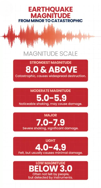


A 7.8-magnitude earthquake struck the Philippines on Monday morning, prompting tsunami warnings for coastal areas in the Philippines, Indonesia, and Malaysia. Initial reports indicate that several houses were damaged and 3 people were killed.
According to the US Geological Survey (USGS), the earthquake occurred at 5:07 am IST. The epicentre was located about 13 kilometres southwest of General Santos City on Mindanao Island.
The Philippine Institute of Volcanology and Seismology said the quake originated at a depth of 10 kilometres, while the USGS recorded the depth at 55 kilometres.
The Pacific Tsunami Warning Center warned that waves of up to 3 metres could hit some coastal areas of the Philippines. Coastal regions of Indonesia and Malaysia could experience waves of up to 1 metre.
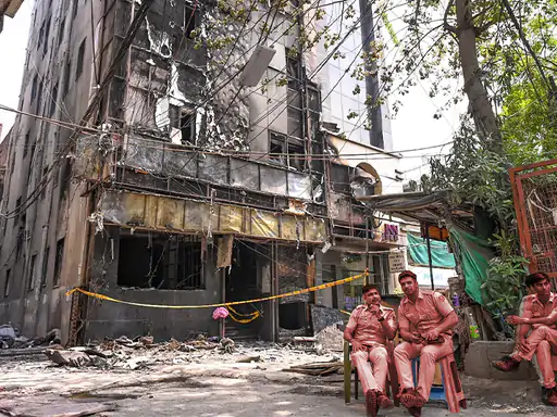
Pictures related to the earthquake in the Philippines…
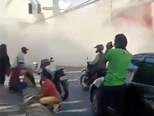
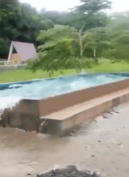

Power outages reported in several areas after the quake
Master Sergeant Robert Dagan of the General Santos City Police told AFP that several buildings were affected and rescue operations are ongoing. Power outages were also reported in parts of the city. The tremors were so strong that people rushed out of their homes and offices onto the streets.
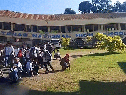
The General Santos City administration released photographs showing extensive damage to shops and buildings. Benjie Ancheta, police chief of Alabel town in Sarangani province, said cracks had appeared in the police station building as well.
“This is the strongest earthquake we have felt here,” Ancheta told Reuters. According to him, some people fainted out of fear during the shaking.
Philippine President Ferdinand Marcos Jr said he had instructed all relevant government agencies to respond immediately. He directed authorities to move residents to safer locations and begin relief and rescue operations.
Tremors felt in Indonesia as well
The earthquake was felt beyond the Philippines. Tremors were reported in Indonesia’s North Sulawesi and North Maluku regions. Residents of Manado said the shaking was quite strong.
Indonesia’s Meteorology, Climatology and Geophysics Agency (BMKG) issued a tsunami warning for parts of its northeastern coast. Waves of up to one metre are also possible along some coastal areas of Malaysia.
The Japan Meteorological Agency issued a tsunami advisory for southern coastal areas stretching from Ibaraki Prefecture to Okinawa Prefecture. The US tsunami warning system also issued an alert for Guam.
However, US agencies clarified that there is no tsunami threat to the Pacific coasts of the United States and Canada. No threat has been confirmed for Hawaii either.
Aftershocks continue following the main quake
Several additional tremors have been recorded in the same region since the main earthquake. Experts say these are aftershocks, which commonly occur after a major quake.
Scientists note that aftershocks can continue for days, weeks or even years. In some cases, they can be as strong as, or stronger than, the main earthquake, potentially causing further damage to already weakened structures.
The Philippines, Indonesia and Japan are located along the Ring of Fire, the world’s most seismically active zone. Frequent earthquakes and volcanic eruptions occur there due to the movement of tectonic plates.
Because of its location, the Philippines is considered one of the world’s most disaster-prone countries. The nation experiences numerous earthquakes each year and is also struck by around 20 typhoons and tropical cyclones annually.
In October 2025, a powerful 6.9-magnitude earthquake in Cebu Province killed 69 people and injured about 150 others.